




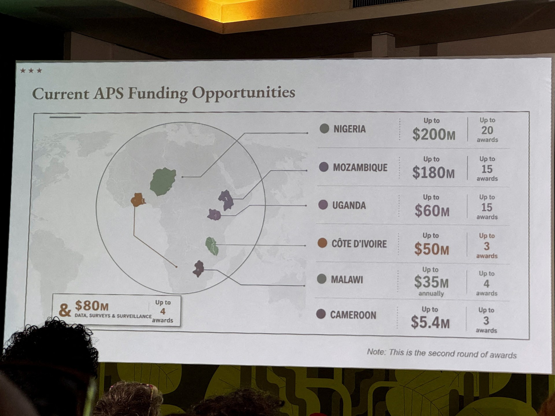
The US State Department acknowledged ‘an unfortunate error’ after the highly inaccurate African map caused a stir.
Published On 31 Jul 2026
United States officials attending a major health conference in Brazil mislabeled the African countries they showed on a map, causing an online stir and a subsequent admission of error from the Department of State.
Attendees at the AIDS 2026 conference in Rio de Janeiro earlier this week took videos and screenshots of the highly inaccurate African map and posted them online, garnering thousands of views – and ridicule from netizens.
Recommended Stories
list of 3 itemsend of list
Video footage reviewed by the Reuters news agency showed the map pop up halfway through a presentation of the US State Department’s controversial new health agreements with African countries, following the Trump administration’s unprecedented and deadly aid cuts.
The map appeared to show Nigeria in the Sahara while Mozambique, which is in southeastern Africa, was placed in the eastern Horn of Africa.
Ivory Coast, in West Africa, was placed on the opposite side of the continent.
Boundaries on the map were also mere blobs and did not represent any real countries.
Top US health envoy Jeff Graham, who heads the President’s Emergency Plan for AIDS Relief (PEPFAR), was speaking at the conference. His past deployments included Ghana and Ethiopia, according to his State Department profile.
Reuters found that the map contained a watermark showing it was likely created with OpenAI tools. The company said it is investigating the incident.
The US State Department acknowledged “an unfortunate error” on Thursday.
In a statement, it said the map was produced by a team member who hastily modified slides just before the event.
“We take full responsibility for the confusion and misrepresentation it caused for attendees, including our African partners,” the statement read, adding that discussions were “substantive and constructive” despite the error and that it remains committed to fighting AIDS.
Before the Trump administration’s deadly decision to pause HIV funding last year pending a review, PEPFAR supported up to 20 million people across the world, and especially in Africa, with life-saving antiretrovirals (ART). The programme was launched under the George Bush administration.
PEPFAR’s core work has resumed, but the US is still scaling back HIV prevention and surveillance. Washington also plans to end the program in South Africa, which suffers the world’s largest HIV burden.
Read the full article here